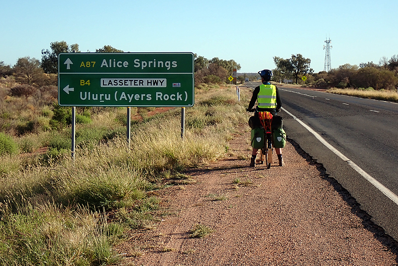
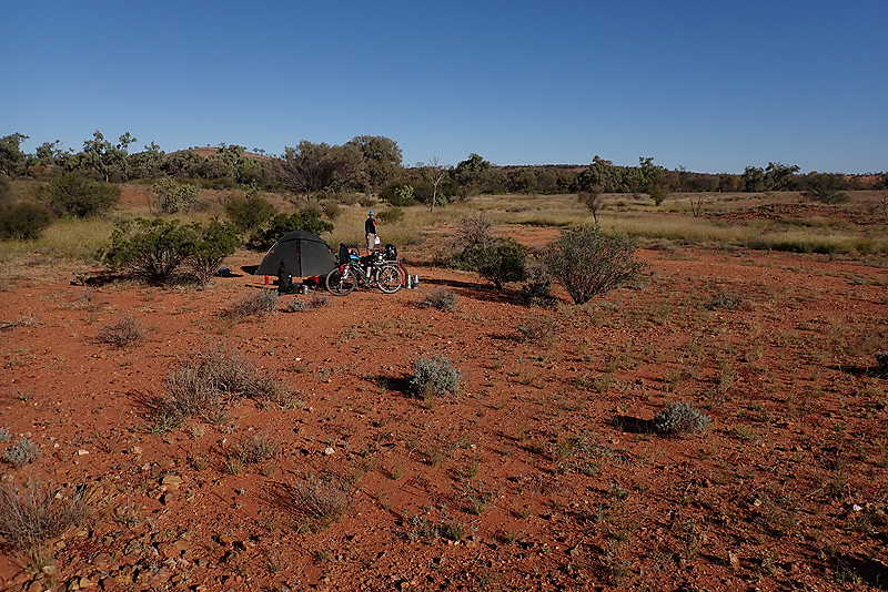
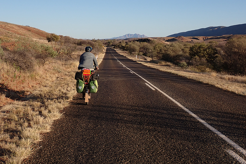
The Northern Territory has a different feel to it. The rest stops are pristine, the South Australian rest stops are usually covered in litter and graffiti. The landscape is greener, much more grassy and there are little rocky outcrops all around. The birds are pretty vocal here too and we have seen more budgies strangely. Last night we fell asleep listening to two owls hooting to each other. We had 30 km to ride to the turn off to Uluru where we would continue straight to Alice Springs. There is a roadhouse and campsite at this junction. We had originally planned to camp here but have pushed ahead. We still struggle to grasp that these places can offer accomodation and camping but the water is undrinkable. When planning this trip we did not consider this and even if we had, it would not have made any difference. There are few places to get water anyway without omitting some if they have only bore water. I went to ask at reception about water and the guy gave the standard response, "Yes, you can get water but you should not drink it. You can buy water in the roadhouse." As we had to buy some more food we went in there and the water cost $6 for 1.5L bottle. They had a small supermarket and everything for sale cost a ridiculous amount. The prices these places charge is really extortion. It is not as if we are dealing wiith remote areas here; Alice Springs is only 200 km away. They charge these prices becuase they can. Suffice to say we were not going to buy the water so I went back to the reception and told the guy we were going to get water from the tap. He was keen that I understood that it is not recommended and I assured him that I did understand that and asked him, "What do you drink?". He replied that he had drunk the water and it presented no problems. Enough said! While I was going to and from the tap with various bottles (Mike was uploading the website), a lady who was camping in the caravan park told me it was bore water and I should not drink it. Afterwards we were sitting outside the roadhouse and a lady came along to chat to us. She was a teacher on the APY Lands south of the NT/SA border. We asked her about the water and she said if it was bore water, it was fine.
We headed off and met up with the cycle tourist couple whose faint tracks we had seen ahead of us on the Oodnadatta Track. They were very excited to see us and we chatted about our journeys. After that, there was a crosswind and it was a bit irritating as we left the area. The road was also quite a bit busier with mainly car traffic. A couple of roadtrains passed us. The second one passed on a slight downhill and as it passed it cut off the sidewind gust and it seemed a combination of factors caused me to have a pretty dangerous speed wobble. I knew I was swerving close to the road train, which to be fair could have given us a bit of space as there was no oncoming traffic, and I also knew that I had no actual control over the swerving. A road train is long enough to count down as it passes, you can count off three seconds which is how long it takes going at 130 km or whatever speed they travel at. So I sort of watched it pass in slow motion and then it was gone and I was upright. Whoo hoo. I felt a bit rattled. Mike felt a bit rattled too.
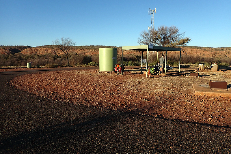
We decided to take a long break at the next rest stop which had a water tank which we are happier using than the previous borewater. We had to take the borewater though in case the tank was not there or was empty or broken. We found that the tank tap was just dripping and when you depressed the button it did nothing so obviously the leaking tap had not been repaired and the tank was empty. We sat down to eat bread and jam sandwiches and Mike thought "Hang on, if we collect the drips maybe it will fill a bottle." We ended up staying for about an hour and a half, putting one bottle under the dripping tap at a time and slowly but surely they all filled up. Mike UV Steripenned them after. A convoy of 4WD-ers pulled in and they came over to chat to us. They are reallly friendly and nice to talk to. After we left the wind did not seem so bad and we ended up putting in a longer day than we planned. We found a good bush camp spot and are now just relaxing. Only 146 km to Alice.
We were both awake at 05:00 so got up early. It was very cold, about 1 deg C. We wore tights to ride in for the first time and I rode in mine all day. We had this cross/headwind which was a bit crap but many places to rest; our first being a rest area popular with caravans. We got a bit more water from the very large and slow dripping tank. The road was not as busy as yesterday and we just sort of put our heads down and chipped away. A road train approached from behind and as it was a double white line and a bit of a blind rise he was probably worried about passing us and finding something oncoming, so he gave a low pitched hoot. We hopped off the road pretty quickly at that! We reached Stuarts Well which is the last roadhouse before Alice. It had been a recent intention to get to Alice tomorrow, but now with the headwind and then 4 nights in Alice there did not seem much point. Better to enjoy a bush camp out here. We had a great lunch though and you could camp there if you wanted. They let us take water which was actually drinking water. We contacted a campsite in Alice to book a site for a night, after which we have two nights in a hotel. Quite a few people chatted to us, one couple we had met in Marla and another man who told me he had passed us a couple of times. And another friendly Sandgroper (from Perth) who had recently cycled the WA Pipeline Challenge offered Mike some advice on the cycle route between Kalgoorlie and Perth. People are very friendly here. After this we stopped about 8 km later at a dry creek where there was a good spot to camp and spent a long relaxing afternoon. We only have 80 km to Alice but as we have time to kill and it will be windy over the next two days, we will take it easy.
COLD morning: 0 deg C. Frost was forecast, but there doesn't seem like enough moisture around for that. The rising sun turns the rocky hills red. We had our first glimpses of the MacDonnell Ranges. Our first stop was another nice rest stop after 25 km. We can't praise the NT highly ehough for these stops. They clearly state that 24 hour overnight camping is allowed, but we've never made use of them for that. They are spotless, all bins are emptied regularly and there are toilets and a trickling water tank at each. After this the wind picked up again and we were straight into it going uphill. Well, what classses for uphill on this trip i.e. not very uphill!! The road is not as straight anymore as it undulates through low hills, so often there are overtaking restrictions on one or both sides. Makes one very aware of what is coming up behind! We clocked 2000 km at the same time as we hit the high point of the entire trip - 630 m.
We thought about camping with about 30 km to go into Alice, then we hit our first road construction stop/go of the trip. It was a long 5 minute wait but we only had one caravan and a car on our end and it was pretty easily done. Just after this the road crew had forced a track off into the bush which was great as we could get a bush camp in the clearing alongside the fence set far back from the road. We often spot this area running for ages along each side of the fence (firebreak we presume) but can not often get access due to thorny scrub. We had a long afternoon lying about in the shade, unfortunately many flies still about. We have 26 km to ride into Alice tomorrow.
We were up early and on the road at 6:45. Since the Oodnadatta thorn experience we unpack the bikes first and then carry each bike on its own over any potential thorny patches, placing them safely on the red dirt, and then go back for our panniers and bags. In the morning this process is reversed. So we treat them with kidd gloves where we can and the rest of the time they have to just deal with whatever is thrown at them. Or whatever we throw them at. The ride was clearly super short; the Stuart Highway was super busy around Alice with people going off to work at the prison outside town but no road trains. We arrived around 08:30. So much to do in the "Big Smoke"! We have been making lists and editing them for days. You don't want to forget anything! This is the only actual town we have been in since Adelaide. Apologies to Nurioopta, Clare and Quorn. Okay, maybe it feels like the only other town. Nurioopta was pretty decent actually. Anyway, we proceeded to cycle all over the town doing this and that. First stop Woolworths to buy the necessary food for Alice-Yulara (next stage), then to Subway because we have not seen one of those since Adelaide (delicious), then to Lone Dingo Outdoor Store to buy two 4L MSR Dromedary water bags to compliment our new frame bags (which hopefully arrive by Friday, ordered last Thursday EXPRESS so you would hope so), then numerous hardware store type places in the industrial area of town and a bike store - Ultimate Ride Bicycle Centre. We will return there tomorrow.
Alice is a great little town actually, very easy to get around by bike, people are very friendly and everything is close together. It was only about 1 km from the bike store to our campsite and we had a lovely hot shower and relaxed a bit.
The day started with Mike having to take his bike in to the local bike store to get a bidon cage bolt which had sheared off removed. We had popped in to Ultimate Ride Bicycle Centre yesterday and Chris was a little concerned that the threads would be damaged in the process but offered to give it a go which seemed more sensible than us buying a tool to do it ourselves. We agreed to bring the bike in this morning at 9:00 am. Chris sorted it out without a problem while we sat in the alley way and drank our flasks of coffee. We then headed back the the supermarket to buy the food we wanted to mail to Yulara. Yulara does have a supermarket, but things like Powerade and Milk Powder would likely cost a fortune there, so we bought 12 kg of staples for the last leg of the trip and Mike then boxed them up and we mailed them. A few locals stopped to have a yarn while this was going on and I even saw a lady we met at Oodnadatta who could report on the road conditions near Kings Canyon; always helpful.
We relaxed a bit in the town centre and then it was 14:15 and we made our way to the hotel. En route at a lowly traffic circle, I nearly stopped in the middle of the road for the profusion of sturt desert peas growing there in abundance. They were amazing! We had to wait for our room until just after 15:00. The room is perfect and we are happy to be indoors and in LUXURY for a couple of nights. We also realised why all accomodation is booked out in Alice; the Shitbox Rally (yes it is a real thing) starts on Saturday here.
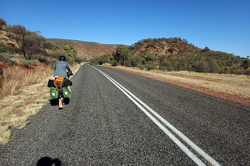
We ended up back at the bike shop this morning for a small replacement part, and got onto our route proper around 10:00. We were pretty excited to be using our new Revelate Frame Bags in which we are storing water bags. We wobbled a bit again, you would think after 2000km.... but it was the extra weight in the form of water and food for 10 days. It was a perfect day and we easily got onto the Simpson's Gap bike path which is 17 km of SEALED dedicated bike path that takes you from the outskirts of Alice Springs to Simpson's Gap through the bushland. It was fabulous cycling along this little route which offers picnic tables and tank water. We had it all to ourselves. Bit of an issue getting on and off the route thanks to very narrow barriers which we had to lift the bikes over. The West MacDonnell Ranges started to reveal themselves and they are beautiful.
We paid Simpson's Gap a quick visit, it has toilets and drinking water as well as BBQs in the picnic area. The facilities provided by NT National Parks are great. At this point we joined Larapinta Drive which is the road to Hermansburg. It was a lovely ride. It's a narrrow bitumen road, the cars were mainly locals and we only saw one caravan. We had planned to camp at Stanley Chasm, but instead found a bush camp just before the turn off. We will probably not go there as we have the larger waterholes coming up of the next two days. At camp we found that another bracket used to fit a water container to Mike's bike had cracked. The biggest challenge on this trip has been carrying enough water and we are keen to see how the frame bags go long term with storing water. We also now have 6 water bladders in total making up 34 litres, and increasing our total capacity to 52 litres!
The road was busy from early as there is a trail run along the Larapinta Trail this weekend. We both felt a little tired this morning, must be the hotel stay wearing off. The scenery from the bike was very beautiful though, and so we soon fell into rhythm. We saw our first red tailed black cockatoos which was great. We also heard the owls again last night, hooting to each other. We cannot recommend this road highly enough. The West Macs are an absolute visual feast with their ochre shades and amazing textures. Whether by bike or car, this route is a must. Our stop of the day was Ellery Creek Big Hole which has a wonderful, cold swimming hole which we made use of. There is camping and a water tank, and even flush toilets. The campsite has gas BBQs and firepits and only costs $3.30 per person per night. We were amazed at the value. We chatted to a girl who is hiking the Larapinta Trail and having a rest there. Last night a dingo stole her hiking boots and ate the laces. After this we rode another 10 km or so to a great bush camp just after the turn off to Serpentine Gorge. We are on dingo-watch tonight!
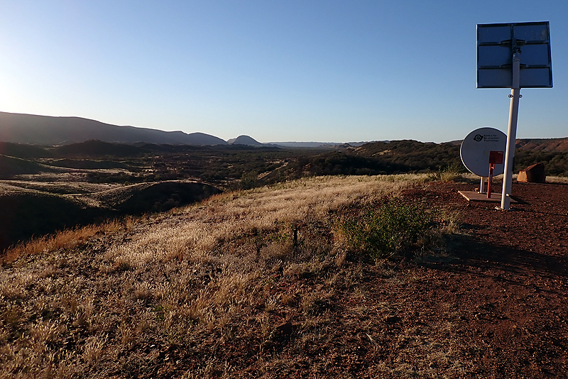
The day was long with highs and lows. Mount Sonder came into view from early on and we had a wonderful view of almost everything from a lookout just before the Ochre Pits. It was on a hill so a bit of a climb but offered a great view, rubbish bins, a water tank and the NT traditional "Mobile Signal Booster" device. This is just a metal pole with a spot to lean your smartphone against which obviously points in the right direction towards a mobile phone tower, and in this case it also had a dish to concentrate the signal. . They are even advertised on the road board which indicates the turnoff. After this the views just got more and more spectacular all the way past Glen Helen Gorge and beyond. You just keep moving through the valley between towering mountains on one side and the wavy rock folds on the other. It is so amazing how the greenery of so many different types of plants and trees contrasts with the brilliant orange of the rock. It looks almost artificial it's so pleasing on the eye.
We did not stop at Ormiston Gorge as Redbank Gorge was near the end of the day and we would need to pick up a lot of water for the next 3-4 days. We also wanted to have a refreshing swim at the end of the day. It looked like the road to the gorge was bitumen but I am only basing that on a quick glance down it, the sign on the road advertising a coffee kiosk, the fact that the campsite has showers and also we think an AAT bus went down there. It is a 16 km round trip as well so a bit longer than the 10 km round trip for Redbank. A while later Mike's back tyre got squidgy and we had to stop to fix a puncture. Even this could not upset us, the day was too beautiful, the road too easy and the traffic too light. As we reached the turnoff to Redbank he had to stop again as the tyre was going flat and this time put in a new tube. The road to Redbank Gorge was gravel and dodgy with some small corrugations, sandy patches and creek crossings with river rocks at the low points. As you neared the end there was a sign that read "Camping" and an arrow pointed to go on for "Day visitors", presumably heading for the gorge. Suddenly the road disappeared beneath us as it plummeted downward only to rise again. It seemed totally crazy that anyone would drive down there in anything other than a 4WD. Bit of a climb to the picnic area and then a 1.2 km WALK to the gorge to swim. We were hot and thirsty and hungry by now and left the bikes to go and fill up water containers (we filled some of them at the viewpoint earlier). The water tank is tucked out of the way on the end of the Larapinta Trail as it is for walkers mainly. We met a couple who had just finished the trail and had a chat. After getting the water, Steripenning it and having some Powerade (we carry it in powder form), the idea of walking 2.4km for a swim seemed ludricrous. We had a look at the path but it was just a little track. We felt a bit sorry for a group of three hikers who were presumably camped up at the top which meant they had already had a trek down to the day visitors area only to find they had still further to go. I was really cross as I wanted a swim, as did Mike, but it was already 13:30 and this would add at least an hour to the day. Plus we still had to get up the crazy hill and ride back to the bitumen. So we set off at 14:00, without the swim. We had plenty of water though, 50L between us in fact as this is the last water point for us until Kings Canyon, 230km away. We ended up having tp push our bikes up said hill, with Mike coming back to help with mine. After this, going along the gravel road, Mike finally figured out what the rattle on his front rack was, the strut on the other side had broken in the same way as the one we fixed along the Stuart Highway. So we pulled into a creek bed and he fixed that. We rode on until 16:00 which is a long day for us with a 07:00 start and not much downtime today, so we were exhausted and happy to find a great little bush camp, have a good shower and go to bed. As I said, highs and lows.
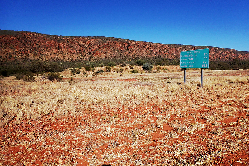
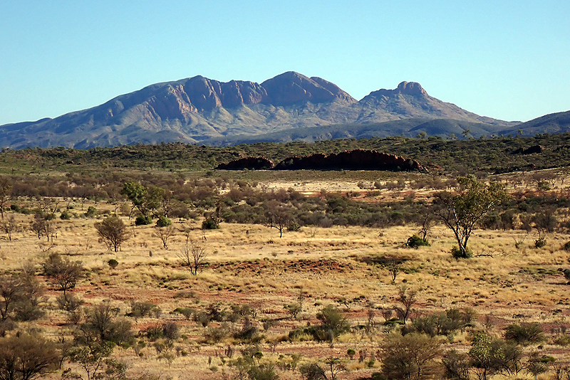

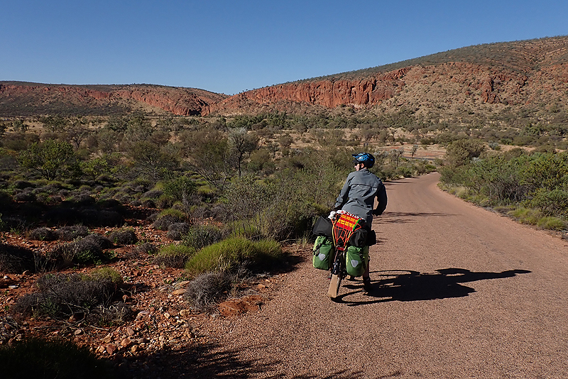
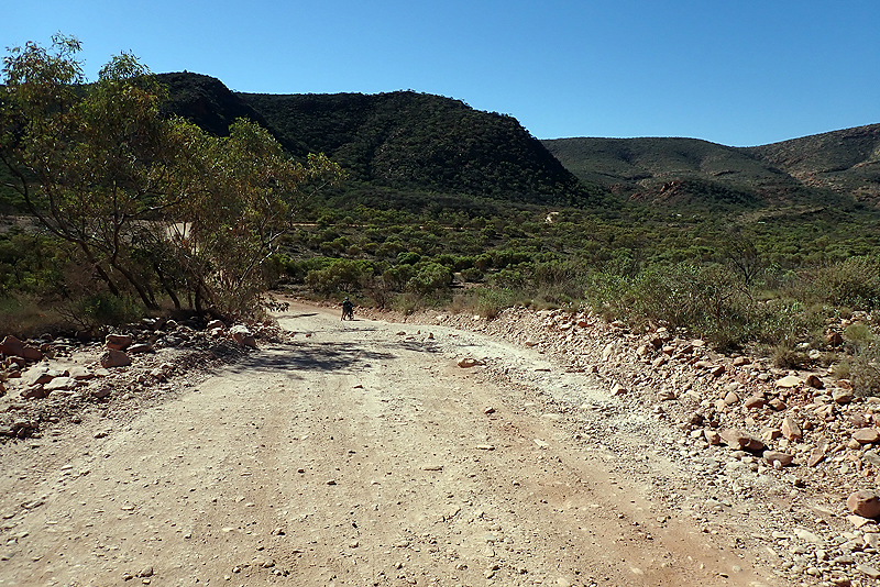
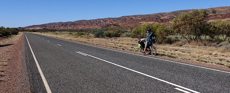
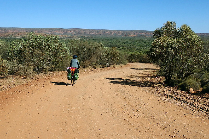
We had some big drops of rain in the early hours and on waking and it was a cloudy morning which suited us as it was cool. Our bush camp was under seige by ants which wanted to crawl into the tent too. Interesting experience for both of us taking a sip from our water bottles first thing and getting bitten on our lip and tongue by ants that had taken up residence inside. We had a really nice climb up Tyler's Pass and walked up to the lookout as it was a little too steep for us on bikes. What a surprise awaited us! The view of Tnorala Crater (Gosse Bluff). We could not believe it. We knew about this crater left by a comet colliding with the earth many million years ago, but we did not expect it to be so impressive. I had sort of pictured a big hole in the ground, and am amazed that this place does not have the same magentic pull as Uluru, it is so spectacular. Apart from Tnorala, the views of the surrounduing ever rolling hills certainly rival anything we have seen in the Scottish Highlands and Outer Hebrides.
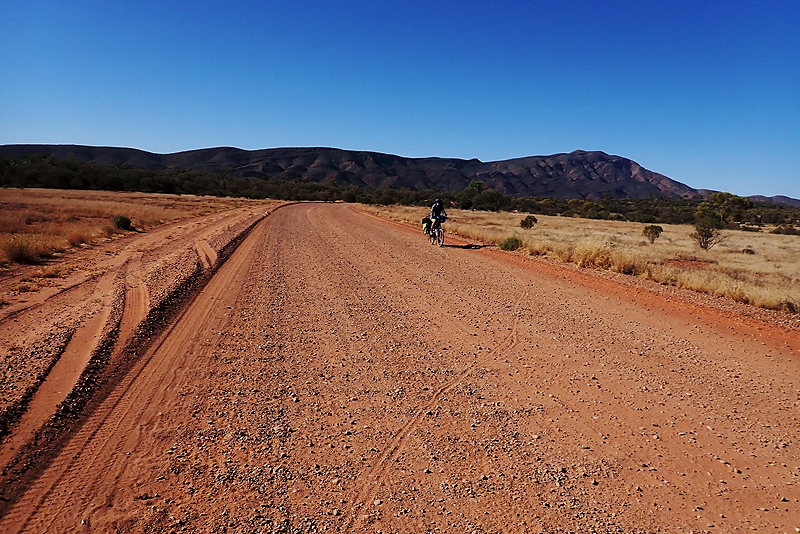
After this we dropped down and passed the turn off to the crater where you can drive inside it. We were satisfied with the views we had had from the pass. We stopped for coffee and it was not too much further that we took the righthand turn off Namatjira Drive onto Larapinta Drive where the bitumen gave way to gravel. We had chatted to a few people who had recently driven the Mereenie Loop Road and we knew it had recently been graded. Whether that was a good thing or not depended on who you spoke to. We have found the road to be very good with mostly hard packed gravel sections that we can aim for on the bike, avoiding the sandy corrugations. The road was pretty quiet with most drivers very accommodating. Afw others seem to be in such a hurry, who knows what they actually see. The corrugations seemed worse on the righthand side of the road for us so it seems most traffic runs from Kings Canyon north. A group of motorcycle tourists stopped to talk to us. They were from Perth and had ridden the Great Central Road to Uluru and gave it a glowing recommendation so we are pleased to hear that. Having completely left the gorges of the Namatjira after Tyler's Pass, suddenly we were riding towards another amazing rock corridor and we took the opportunity to find a great bush camp and have an early end to the day. The moon tonight is looking a little embarrased as tomorrow night is a total lunar eclipse; we are hoping for clear skies.
It was a windy night and we woke to a bit of rain and heavy cloud so we kept our rain jackets out. As we left the bush camp there was a group of wild horses over the road. We saw another group later and later still a group of what looked like donkeys, but with shorter ears. After a bend in the road through the hills the road surface got a lot worse. We thought about the enthusiastic motor bike rider we spoke to yesterday and kept hoping for his "really good" road to appear. It took 40 km. Prior to this the road was widely corrugated and difficult to ride, but hardly any traffic. At 40 km we chatted to a carvanner who stopped in the road, also from Perth. He had also driven the Great Central Road and reported the road condition to be "better than this". Then we hit the really well-graded section of road which was a pleasure to ride and provided some great views. Whilst resting by the roadside, Mike said, "There is water dripping from your frame bag". Sure enough, one of our brand new Nalgene bladders has a puncture. Back to the drawing board. We wonder when the gear problems are going to end, but the corrugations are playing havoc with our stuff with regards to wear and tear.
It was cold and overcast all day, such a change from the weather two days ago, or even yesterday. We camped with about 65 km to go to Kings Canyon. Unfortunately, it looks like the lunar eclipse is going to be hidden behind clouds. The full moon rise was impressive from the small rise behind our tent but it soon disappeared behind a cloud bank not to be seen again.
Of course the eclipse was a miss but then the bright moonlight after the clouds had cleared kept us up half the night. It was like daylight. Then the wild horses came to visit. "Clip-clop, clip-clop", down the road they came. Then it sounded like they were clambering up the little rocky rise behind us. Our tent was pitched on a small ledge so we did not really want to surprise a herd of wild horses in their moonlight ramblings. Luckily they clip-clopped off down the road. We woke to tackle the road again, which continued pretty much as it left off. The fabulous scenery was now behind us and it was quite bushy. We were a little surprised to see a large truck approach us at snail's pace at one point and we also saw a couple of cars from "Central Petroluem" until we reached the turn off to a gas and oil exploratory site. That explained the state of the road: Very corrugated. As we drew near to a lookout point, the bitumen began and we were very happy with 26 km to go. However, a glance down from the lookout showed that the bitumen was only for the climb and steep descent and then we would be back to dirt and corrugations. We were quite cross. We watched a pilot vehicle close the road on the descent as a road train with FOUR oil tankers came off the dirt and continued to Kings Canyon.
We were very happy to hit bitument again at the start of Watarrka National Park and a 12 kilometres later we were at the campsite. It is big and has many facilities, including a tennis court and swimming pool. We washed our clothes and had a hot shower and then lay around on the grass contemplaiting our new water storage problem with the Nalgene bags turning out to be fallable. Mike had fixed the punctured one with gear aid. We decided just to keep using them and fix them as they failed(?). We will only need them every so often to make up 50 L when required. We checked on our SIX items to be delivered to Yulara. My new fork is there, as is the food we mailed from Alice and also the crown race for the fork. In case you have forgottten, this is the replacement front fork for my bicycle that got two holes cut out of it on the Oodnadatta. Looking at how it is going though, it will probably last the trip! If the roads we have just been on have not caused it to collapse, nothing will!
It was nice camping at Kings Canyon Resort. It was not as busy as we thought it would be. It is strange to think of these places outside the border lockdown, we assume that the international tourists normally make up 50% of visitors. We have been waking on our alarm set for 05:30 for ages now. We started doing it at first because of the heat and then the busy road but now it is actually still quite dark at 07:00 and it seems a little silly to be wearing headtorches until we finish packing. Today we lay in 'til 06:00, special treat, but we may continue getting up later and leaving at 07:30. It was windy today with quite a strong headwind. At first we didn't care, we were so pleased to be on bitumen. For some reason the Mereenie Road really took it out of us. It was not without it rewards, but the road quality hacked us off. It was so slow! So we will enjoy the bitumen until we get onto the gravel on the Great Central Road again. We pulled into King's Canyon early. There are a couple of walks to do. The Rim Walk is the one everyone talks about. Usual thing, "If you build it, ....". We did a short walk that took us to the canyon walls. It is a pretty place, but we have had more spectacular views on this trip. We would not take a detour for it, put it that way. For most visitors this is an out and back drive as they do not or cannot drive the unsealed Meerenie. We class the Meerenie and Namatjira Drive as much more scenic, from a bicycle anyway. I guess they need to think of something to give people to do who sit in a car all day, fair enough. Generous too, as the waterholes and canyon as a whole are very precious to the local Indigenous people. We chatted to a very friendly ranger called Damien, also from WA.
We were actually due a rest day today, having left Alice a week ago, so decided to go as far as Kings Creek Station where we could have a feed and then camp after this. The headwind continued strongly. Many motorists coming towards us waved enthusiastically which was nice. The tiny finches that have been a constant companion on these NT roads fly in large groups in front of our wheels about 50cm above the ground, obviously trying to avoid the worst of the wind. Crazy birds. Lucky for us we placed our order for burgers and chips just as an AAT Kings bus pulled up outside so we did not have to wait. It's strange to be back in tourbus territory, we feel a but like we are in an alternate universe alongside these people. We could have camped at the station but continued further for a bush camp with great mountain views. The station charged the same as the resort for camping, $25 per person which we think is a lot considering we don't really need the facilities they offer, being happiest in the bush. You don't get offered a hiker/biker rate here; not enough hikers or bikers we suspect.
We woke to the same headwind today, which was expected. I forgot to mention that yesterday was really cold (13 degC max) and today was a cold morning also but not quite so bad over the day. It was clear and so the sun warmed things up. The headwind keeps you cold though. It is so strange to think that only a few days ago we were trying to escape the heat. We plannned to ride only 60 km again today. There was some uphill into the wind and not much scenery to speak of. We passed the turn off to Ernest Giles Road which leads to the Stuart Highway, we had passed the other end of it on the highway on our way to Alice. We saw a wild camel in the bush! Wildlife sighting of the week. We entered Angus Downs and there was a stretch of desert oak forest. We have been wanting to camp in this type of forest for a while and it came at just the right time. The forest floor is covered by pine needles, well they are desert oaks needles actually and it is a great experience being in a forest again. Reminds us of Scandinavia, but the desert oaks are quite sparse. We spent the afternoon relaxing. This wind will probably turn more helpful for us tomorrow and if that's the case we might make it all the way to Curtin Springs (120 km). It feels like a long stretch from Alice Springs with not much in between and would be nice to resupply.
Last night we heard drumming and someone playing a didgeridoo, not sure who or where. Bit weird as there was no one around. Lovely peaceful night's sleep under the desert oaks. We set off and no longer had a headwind. When the wind came up around teatime, it was mostly from behind which was a great help. We joined Lasseter Highway after about 60km and making it to Curtin Springs became possible. We had a break at a reststop and again at Mount Connor Lookout. Mount Connor is a flat-topped mountain that many mistake for Uluru from a distance. We can see why - it looks higher than Uluru and similiarly impressive, but not the same shape. We call it Mount Fool-uru. About 40 km from Curtin Springs, roadside signboards start talking it up - FREE CAMPING, HOMESTYLE MEALS, COOLDRINKS, BEERS. You get the picture. Experience should have taught us otherwise, but we started planning to have a lovely meal and a milkshake and then continue on for about 10 km.
Arriving at Curtin Springs after riding nearly 120 km, we were impressed. Green lawns, people sitting outdoors having a meal. We went into the building labelled "Shop, bar" and saw that there were drinks in a fridge and some other things like chips and chocolates. We walked out and went in search of the roadhouse or dining area. By now. the people we had seen dining outdoors had returned to their AAT Kings bus and were on their way. We went back to the store and asked where we could buy a meal. "Kitchen is closed," came the response. I must have looked surprised at this as the bloke went on to say, "Opens between 12 and 2, and 6 and 8", or something like that. At this point Mike lost interest and walked out and I started scanning the shelves desperately for something to buy. The guy went on to say, "We've got chips, cake and pies". I couldn't see any pies so I asked, "Where are the pies?". "There's the sign and there's the microwave", he pointed around the corner. The sign had the names of some pies and the prices. I think a beef pie cost $8. It was probably very delicious. "Manager here doesn't believe in keeping pies warm for 4 days so you warm it up in the microwave when you buy it." I abandoned the pie idea and asked for the last two pieces of cake at $4 a pop. I took out the credit card to pay and then noticed the sign "EFTPOS min $10". "Yeah," he said," With Covid folks were coming in here to buy a packet of chips on their credit card, so the minimum is $10. You can get there by adding a bag of chips." $3.50 for a tiny packet of crisps. I took out a $10 note. "You guys sure have a lot of rules here," I said and walked out. What a rude man and what a ridiculous establishment. When I think of the warm welcome we received at the Oodnadatta Roadhouse and here we are 100 km from one of the most well-known landmarks in the world and this is the attitude? Thank goodness the borders are shut, wouldn't want this guy the face of Australia to foreign visitors. At least we used the toilet and could log in to our internet there. We saw that the campsite was pretty full of caravans taking advantage of a free unpowered site. We were happy to cycle on another 15 km for another night under desert oaks. For dinner we had our now favourite meal - a packet of Deb dehydrated potato, a packet of Uncle Bens rice, and a cup of soup, mixed together. We splashed out tonight and had two packets of Deb. We will hit Yulara tomorrow with only two packs of Uncle Bens left. Pretty good catering!
It was a pretty quick and easy 70 km to Yulara. We could see Uluru and Kata Tjuta from quite early on. First stop on arrival was the IGA supermarket to buy something to eat. We sat on a bench on a green lawn where quite a few Indigenous artists were selling their paintings, one of who came and chatted to us about our trip. After we had had something to eat, Mike went to the post office to collect 2 of our 6 parcels. The 2 were the food parcels, one kindly posted by a colleague of Mike's and the other by us from Alice. He got to the post office at 11:50 and was told that he had to come back at 12:00 as prior to this only parcels addressed to local PO boxes were given out. There was not one other customer in the post office at the time. Much to his credit he did not speak his mind and instead came back to the bench to return to the post office after 12:00. Wow - 18 kg of food to find a home for! Amazingly we packed it all away and headed off to the campsite.
There was a queue of caravans and motorhomes waiting to check in and we slipped passed them all and went straight into reception. This is a very rare occurance for a cycle tourist, getting ahead of anyone at anytime. Someone had commented in their recent review online that they got a special price as they stayed for three nights. We asked about this and the receptionist said that it ended today but he would see if it still worked. We asked what the special was and he said that the third night is free! He popped it in the computor system and it was accepted! So we booked in for three nights but if we end up staying for two we don't lose anything. We found a campspot and left our loaded bikes on it to walk back to the post office to collect our remaining parcels. These included my new front fork and a new tent as our brilliant Hillleberg Staika's zips have been seizing up and not closing properly since before the Oodnadatta, and its life has generally come to an end. We blame the dust of the Flinder's Ranges for the zips. We also went back to the IGA for more food. We picked up more shellite at the Shell service station near the campground. Jenny came to visit us at our tent. She is travelling round Australia in her van and also riding her bike when she can. She completed the Mawson Trail starting beginning May with Cycling SA as a supported event. It was iinteresting talking to her, she had passed us a couple of times on the road. We bought some hot pies for dinner and went up the hill to eat them while having a view of Uluru.
We spent two rest days at Yulara and really enjoyed that. The big task on day one was Mike's, replacing my front fork which is quite a tricky thing to do in a campground in Central Australia without your own tools. He managed like a pro! All went perfectly and my new fork is impressive. It's red, so I should go faster! The bike handles exactly as it used to. Very lucky to travel with a competent bike mechanic! The campsite was pretty busy with people of course coming and going at all hours to visit Uluru at sunrise and sunset. We have been to Yulara and Uluru before, about 15 years ago. We flew that time and stayed at the same campground.The campground seems to have been improved in the meantime, the facilities are much better than we remember and it seems bigger and greener too.
The second day was a bit more relaxed and we had a look at the art galleries in the village. Many of the people at the campsite were interested in our trip and asked us questions. Late on the last evening a girl pitched her tent next to ours. She was also from Perth and is going to hike the Larapinta Trail and filled us in on how to arrange food drops and so on.
We were ready to leave this morning and had a brilliant ride. It was pretty exciting to cycle past Uluru and Kata Tjuta. The latter is perhaps the most impressive. All morning we were treated with views of one or the other. We entered the National Park after about 10 km and paid the $38 per person entry. It is valid for 3 days and so of course we could have purchased it earlier and visited, but as we had already hiked around Uluru and through Kata Tjuta, it seemed more special to save the views for cycling past. Kata Tjuta was about 45 km further on. We stopped at the view site first and it is great to get a view of both Uluru and Kata Tjuta together, seeing them in context. All this way we had been on a bitumen road with a generous shoulder. We stopped to eat at a picnic area at Kata Tjuta and then rode back to turn off onto our next challenge - the Great Central Road. We expected dirt from the get go and were suprised to see glorious bitumen which ended up stretching for the first 13 km. There were two government funding signs which indicated "Road Improvements" with the first telling us it would be 8 km and the second a further 6 km or something. It felt good to be WA bound! This road requires permits, one from the turn off at Kata Tjuta to Kaltukatjara (Docker River) and another from the WA border just after that to Laverton. This is because we were passing through the Aboriginal Lands. The first permit was instant after applying online, the second we did not hear anything about for ages. Mike phoned to follow up and was told that cyclists need to complete an indemnity form prior to the permit being processed. You had to declare that you understood the risks associated with travelling this remote road and release the administrators from responsibiity in the event of your death, amongst other things.
We made telephone contact with them again today as we still had not received the permit, but were assured it is being processed. Just after the bitumen ended, a NT Government vehicle drew alongside us and the driver was VERY friendly, chatted to us about our trip and took a photo of us too! He also gave us brilliant news, that about 15 km ahead we would have 30 km of bitumen to ride just like that, in the middle of nowhere. Best news we have had all day! This stretch from the park to Katukatjara is notoriously sandy and we encountered some of these unrideable sandy patches, but on the whole it was a good road to ride today. Pretty quiet too, with a few tourist vehicles coming from WA and some locals. One ROADTRAIN! We pulled off for him and crossed to the other side to give him plenty of wriggle room, and he gave a brief horn toot of thanks. We camped in our chosen spot which is actually on our map as a camp area. It is off a little track and on a gravel section. We are still camping under the desert oaks. It will be a quiet night out here! We pitched our brand new Staika tent which is indentical to the old one except that you can open all the doors so that means you can enter and exit without diving in head first.
Last night Mike found that ANOTHER bracket used for attaching a water container had cracked all the way along it's length. We started our day swapping a bracket off my bike onto his. Industrial strength cable ties that we bought in Yulara are now required. Advice to future cycle tourists on any of these Ourback roads - don't bother with your average size cable tie. Go big or go home. If it looks like it would work on a road train, it's the right size. We set off past the road maintenance camp, and as the guy advised us yesterday, the bitumen began soon after in all it's glory. We have learnt to take all road information with a pinch of salt, but he was adamant. He even said, "Yesterday I drove about 10-15km on the sealed section as part of it was still closed off, but today I drove the whole way, 30 km". So imagine our surpirse when after 15 km exactly it went as instantly as it had come. Where were the other mystery 15 km? Never to be seen! Pretty quickly it became obvious that it would be a huge ask to ride the planned 80km today. The road was really a sandpit for most of the first 30 km and required a fair amount of walking while pushing our bikes through thick, fine sand. A loaded bike does not like to be pushed through anything so this was hard work. The road is very quiet though, almost all traffic is oncoming from WA.
After a lunch spot a carvanner stopped for a chat. He told us about a good campspot 50 km before Laverton, which was kind. We can't even be bothered dreaming about Laveron at the moment, and we have at least 15 campspots to go before then anyway. The excitement of the day was a camel in the middle of the road which ended up on the run in front of us down the road with it's massive feet plunking along at a gallop. Looked a bit like when a reindeer runs down the road, their feet are designed for sand or snow, not hard surfaces. Also the camel had a hump instead of antlers. Would have been really strange if it had had a hump AND antlers. Anyway, we ended up chasing the camel for a kilometre or three, before it decided to just hop off the road. After this it was a bit of a slog, but the road became more and more rideable. We each dropped our bikes a couple of times, me while I was on it, and getting them upright again with all the water and food loaded requires brute strength, and if it is me, a lot of screaming like an Olympian weight lifter. We stopped for a rest at the roadside and after being used to very tough looking 4WDs and all the sorts of big equipment that seems to accompany outback driving, it came as a suprise when two little old ladies probably in their 80s (no other was of putting it) came puttering along in a Toyota hybrid hatchback 2WD, and slowed down to ask: "Are you going okay?". When we smiled and said "All good thanks" they puttered off towards Docker River at about 30 km per hour. You would have to imagine they are regulars or local to the area. Not one of the old ladies we saw at Yulara would have cooked up a plan to drive on this road in a hybrid 2WD on their own. The landscape and vegetation is changing, the desert oaks have vanished and it has opened up into scrubland, with a few hills in the distance. There are fewer flies today as well. I keep forgetting to mention that the flies were quite bad again around and after Yulara. We found a good campspot about 8 km prior to our planned end point so we did pretty well considering the road condition, but we were on the road from 07:30 to 15:45 which is a long day.
This morning we met a trio of camels on the road and later on, one solo camel. This brings total camel count to 6. As the morning sun was behind us they made no attempt to move off the road at first as they couldn't see us and as the bikes are pretty quiet probably couldn't hear us. The solo camel in particular just stood there and stared us down before lumbering off when we were a few metres away. The first half of the day went really well, the scenery was lovely with rolling hills and the desert oak forests are back. A man in a 4WD drew level with me and slowed down to my speed, "Where ya' goin'?" he asked. "Perth, " I replied with a smile. "Where dja come from?". "Adelaide," I returned. "So 'bout 3000 km then?" he asked. I laughed as I looked at the total trip distance, at that point 2980km. "Yip, just about!" I said. "Well, keep pedalling!" he said and drove off. We stopped at Lasseter's Cave for tea after 34 km which was pretty good going and shows the road surface was quite good. The picnic site had the usual water tank, table and benches , BIN (always welcome) and fire place. The cave itself was only a few metres walk. This poor bloke holed up here for 25 days in January 1930 after his camels bolted and he had no food. Finally he started walking towards Uluru with a couple of litres of water in the hope of meeting up with his supply party and with the help of local Aboriginals. The purpose of his journey had been to look for a gold reef. He wrote in his diary found at the cave later that all the gold in the world is of no use when you need a loaf of bread. He died of starvation shortly after leaving the cave area. 1930 was not even so long ago. It is surprising how recently these parts of Australia were visited by white Australians.
After this rest the road continued quite good for a while, until the 50 km mark and then things took a bad turn. The sandpit returned. A lady passing in the other direction stopped to commiserate with us over the "shit road". She said unfortunately it continued the same way for about 5 km. After this we were walking the bikes, until the road got too sandy for that even. We had to drag them up over the sandbank at the road edge and then walk through the bush with them for about 2.5 km. I just hoped that there were no snakes. This took about an hour. Mike went to have a peek at the road at various intervals, and when it looked good enough, we dragged them back onto the road and were able to cycle again, sometimes with speeds up to 25km per hour! After a few more km we decided to call it a day and grabbed a good bush camp very well hidden from the road. We were only 10 km from Docker River, but it was 15:00 and as the village store was already closed there did not seem much reason to continue further, and we thought there was a higher chance of solitude here. After eating and showering we were sitting in the tent when we heard a metal drum being rolled through the nearby bush. Then we heard it being loaded onto a vehicle and the vehicle slowly pulling off along the road. It did a u-turn and stopped, and we heard voices. Mike put his head out the tent as an elderly local man came walking into the clearing. "Hello!" the man shouted. "All alright?" We said yes and he gave a big thumbs up and laughed his head off and walked away.